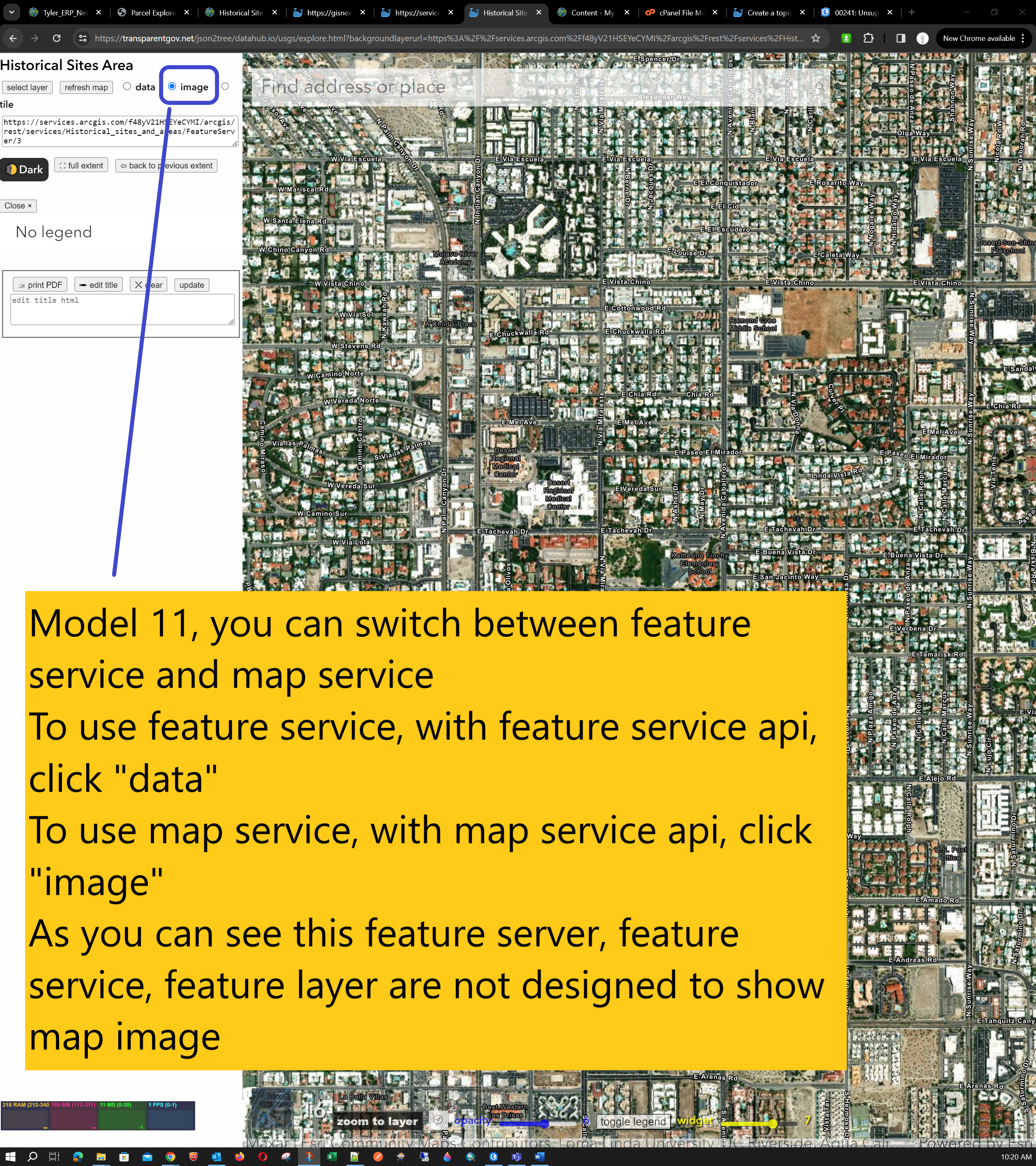
Model 11, you can switch between feature service and map service
To use feature service, with feature service api, click "data"
To use map service, with map service api, click "image"
As you can see this feature server, feature service, feature layer are not designed to show map image
https://transparentgov.net/json2tree/datahub.io/usgs/explore.html?backgroundlayerurl=https%3A%2F%2Fservices.arcgis.com%2Ff48yV21HSEYeCYMI%2Farcgis%2Frest%2Fservices%2FHistorical_sites_and_areas%2FFeatureServer%2F3&layer=Historical+Sites+Area&_center_zoom=16&_center_lat=33.83554995793386&_center_long=-116.53989814729394&backgroundtype=image
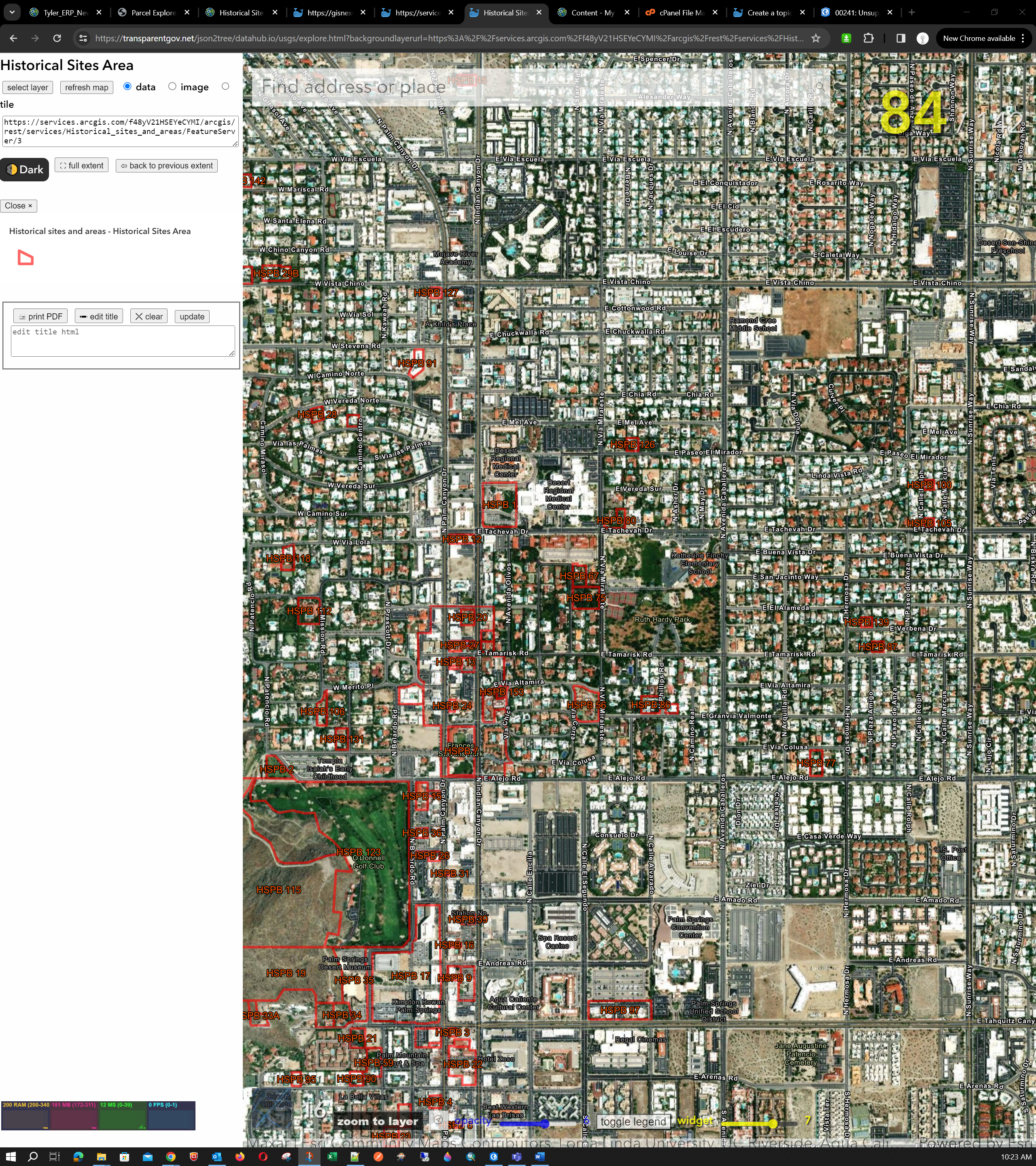
However, if you switch to 'data', use feature service, feature service api, you will see json format data rendered correctly.
https://transparentgov.net/json2tree/datahub.io/usgs/explore.html?backgroundlayerurl=https%3A%2F%2Fservices.arcgis.com%2Ff48yV21HSEYeCYMI%2Farcgis%2Frest%2Fservices%2FHistorical_sites_and_areas%2FFeatureServer%2F3&layer=Historical+Sites+Area&_center_zoom=16&_center_lat=33.83554995793386&_center_long=-116.53989814729394&backgroundtype=data
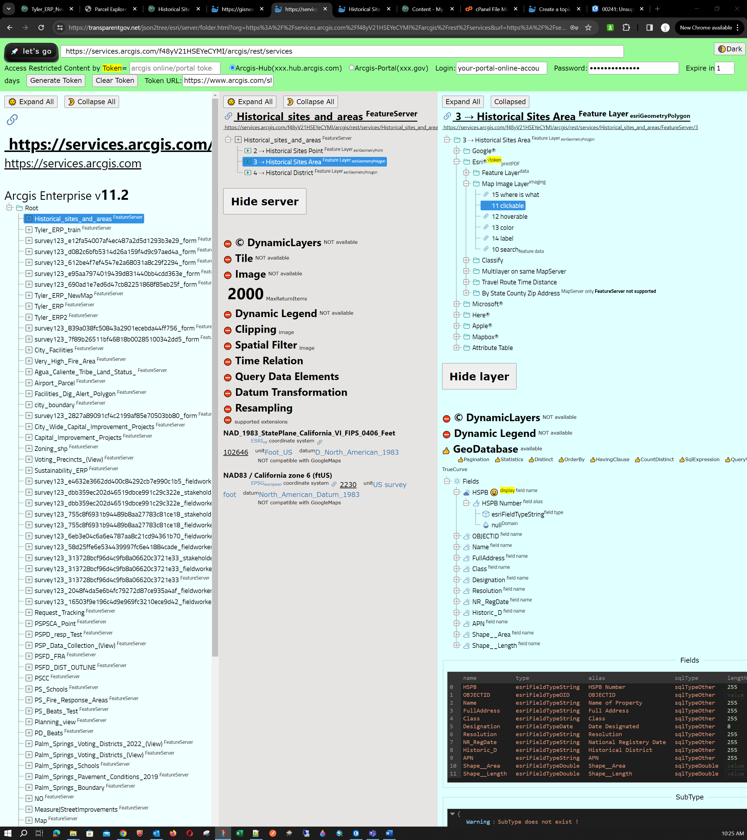
https://transparentgov.net/json2tree/esri/server/folder.html?org=https%3A%2F%2Fservices.arcgis.com%2Ff48yV21HSEYeCYMI%2Farcgis%2Frest%2Fservices&url=https%3A%2F%2Fservices.arcgis.com%2Ff48yV21HSEYeCYMI%2Farcgis%2Frest%2Fservices&select_folder=1&select_layer=3&arcgis_online_token=