911 CAD dispatch software use esri network anaysis product, which require POI address split into separated column.
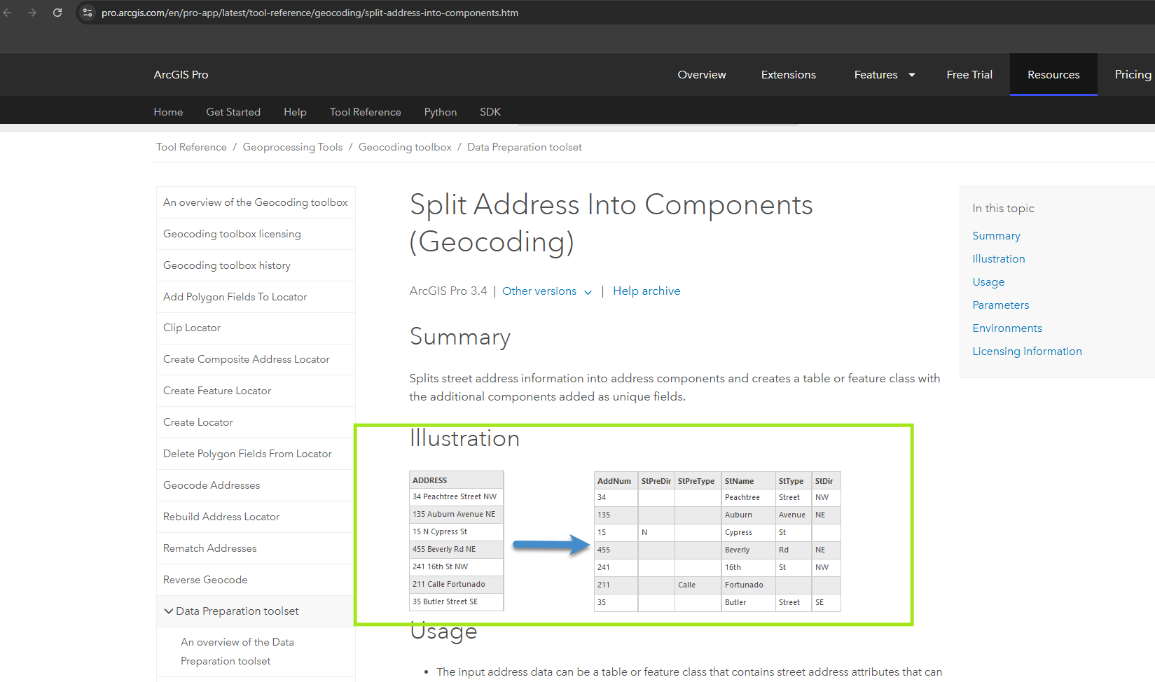
Normally you need use Arcgis Pro Split address tool to split POI address. see sample below. This function require you pay extra money beyond standard esri license. You have to buy esri pro license which is about 40k per year. Not worth it. Why not make home-made version, with even better quality.
https://pro.arcgis.com/en/pro-app/latest/tool-reference/geocoding/split-address-into-components.htm
Now I have build-in split address function into download POI button. So you don't have to have esri license, you don't have to learn how to use Arcgis Pro. You don't have to learn how to use split tool in arcPro. All you need is a browser, you click download POI button, the splited address will be ready for you.
Step 1.
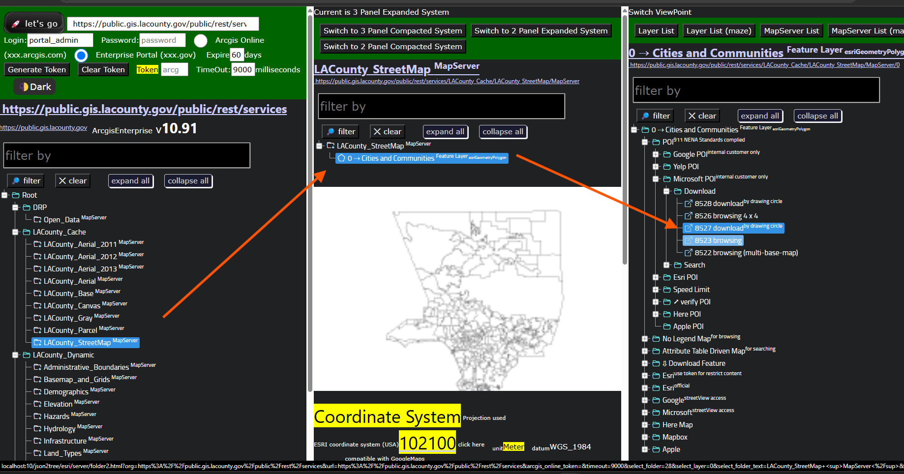
model 8527
Step 2.
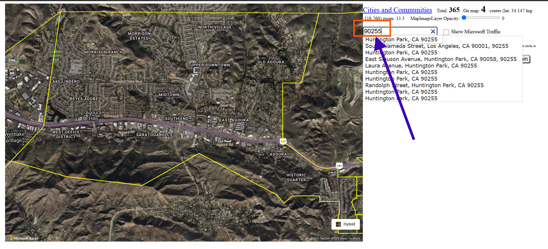
search zip code, where you want to go
Step 3.
yellow line is city boundary of all 200 cities in los angeles county, find the city boundary that you want,
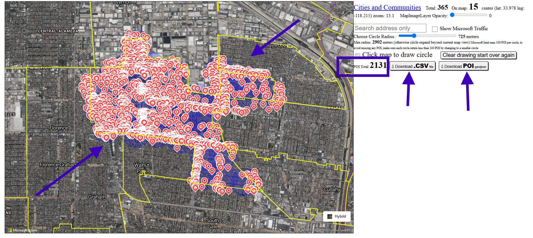
click inside city boundary to draw circle. keep drawing circle to cover entire city boundary.
Step 4.
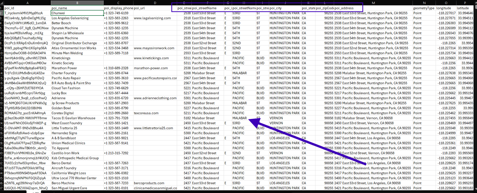
click dodwnload poi. csv button, open the csv file you just downloaded, address is split into separated columns.
Step 5.
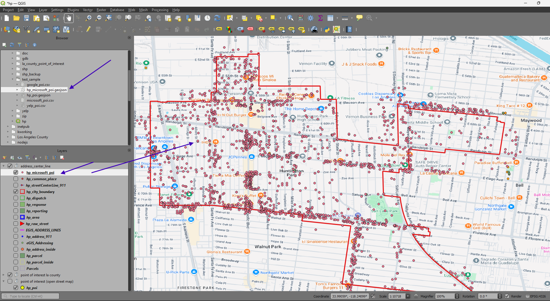
click dodwnload poi. geojson button. Use ArcPro or Qgis desktop app to open your just downloaded poi. geojson file
Step 6.
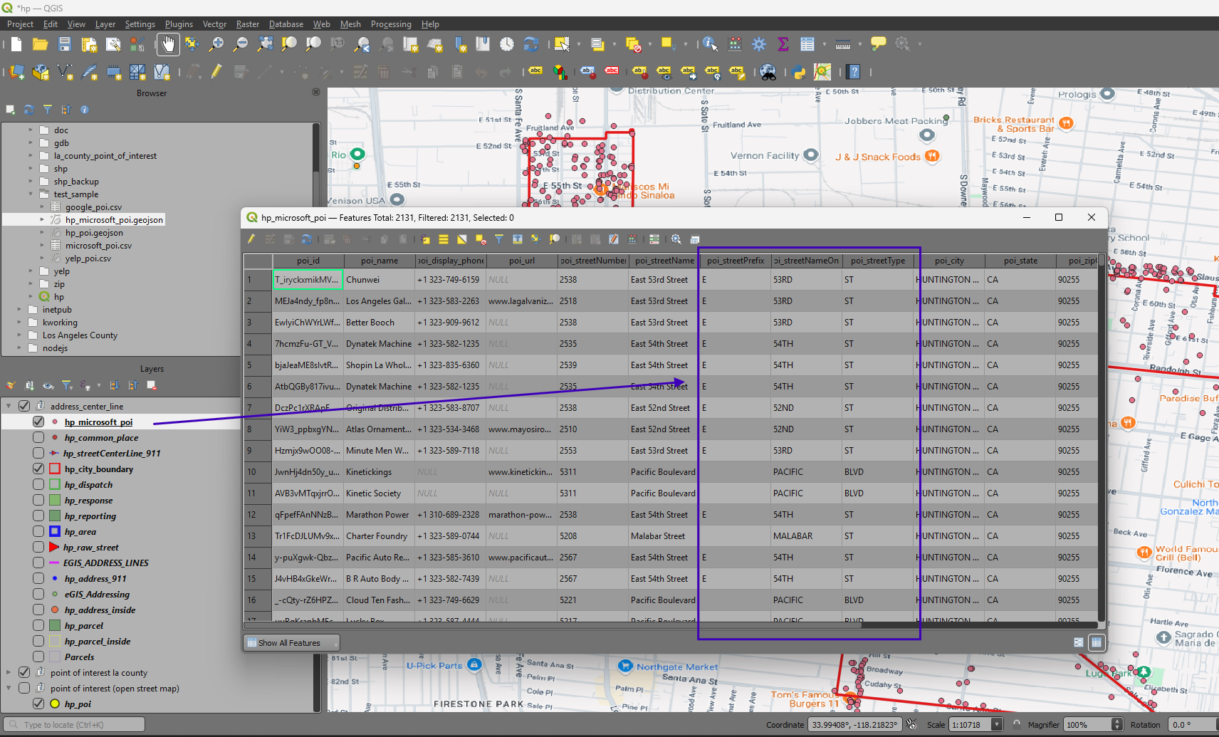
As you can see, the address already split into separated columns without you notice that. The automatic splitting address happen when you click download POI button.
Step 7.
Step 8.
Step 9.
Step 10.
Step 11.
Step 12.
Step 13.