Step 1.
https://transparentgov.net/cleargov1/1819/how-to-find-any-city-building-foot-print
Step 2.
How many building do you want to download? 3 million building for whole county ? or just a few thousands for a small city ? or 1 million building for large city (los angeles) ?
There are several options, costly and free, each have good and concern.
Step 3.
For 3 million buildings for whole county, you could use FME ($20k) + Esri Arcgis Pro ($5k-40k/year)
You have to do training on how to use FME or search keyword FME on this website to learn how to use FME to download web service layer.
I used to download very large state's web service layer with ArcPro failed, but with FME successed ! FME ($20k) is more stable than ArcPro for download multi-millions data without crash ! You get what you pay for here.
Step 4.
For less than 1 million data size, you could use Esri Arcgis Pro ($5k-40k/year) or Qgis (free). You have to do training on how to use ArcPro. Or search keyword download on this website to learn how to use ArcPro to download web service layer.
ArcPro may crash depends on the downloading size and web service layer data format, or other cause. The larger size, more likely crash due to run out of memory or some other bugs that ArcPro hasn't fix. If you have 64GB RAM is obviously less likely crash than 8GB RAM.
Step 5.
For a few thousands or less, without FME license, without ESRI license.
You can use the free tools on this website. No training needed, public user know nothing about ESRI still can download with a few click. There are a few options, download by draw square, draw circle, or draw polygon or draw rectangle. I only show draw square tool here, you can try other model, they are all have same idea.
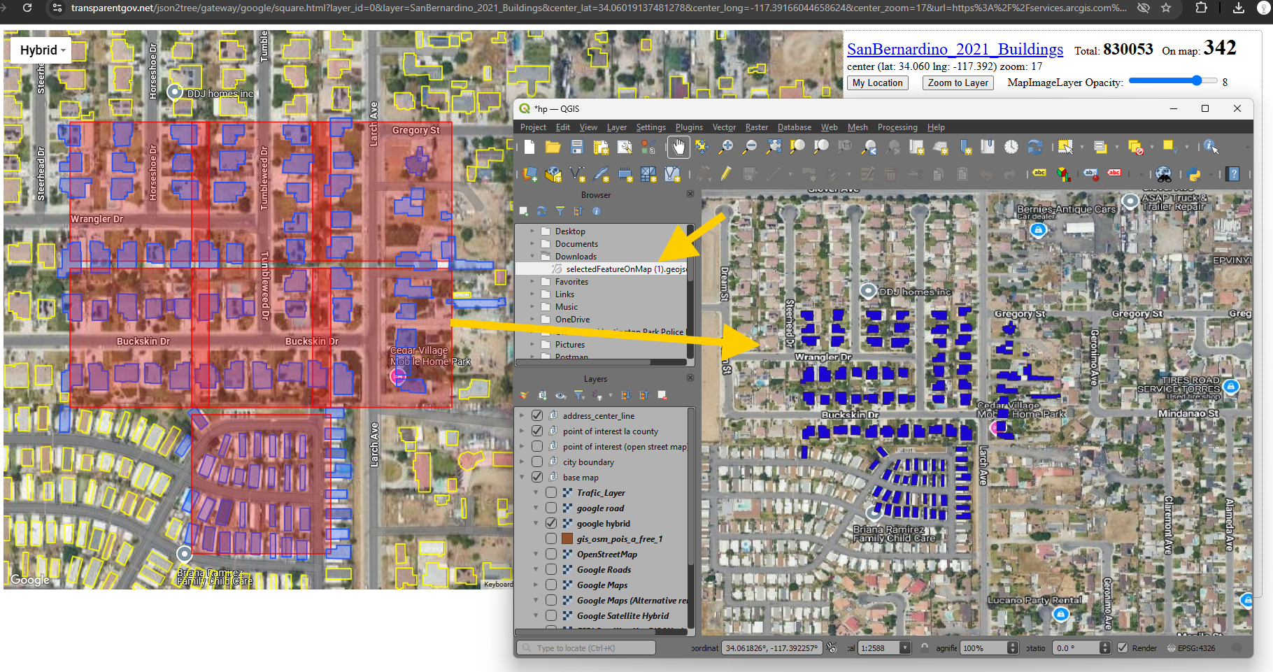
Step 6.
draw square tool model 6323,
click anywhere on map, draw square to select building, then download
https://transparentgov.net/json2tree/esri/server/folder2.html?url=https%3A%2F%2Fservices.arcgis.com%2FaA3snZwJfFkVyDuP%2FArcGIS%2Frest%2Fservices&org=https%3A%2F%2Fservices.arcgis.com%2FaA3snZwJfFkVyDuP%2FArcGIS%2Frest%2Fservices&arcgis_online_token=&select_folder=9&select_layer=0&select_folder_text=2D_Building_Footprints_2021+%3Csup%3EFeatureServer%3C%2Fsup%3E&select_layer_text=0+%26%23x21E2%3B+SanBernardino_2021_Buildings+%3Csup%3EFeature+Layer%3Csub%3E+esriGeometryPolygon%3C%2Fsub%3E%3C%2Fsup%3E
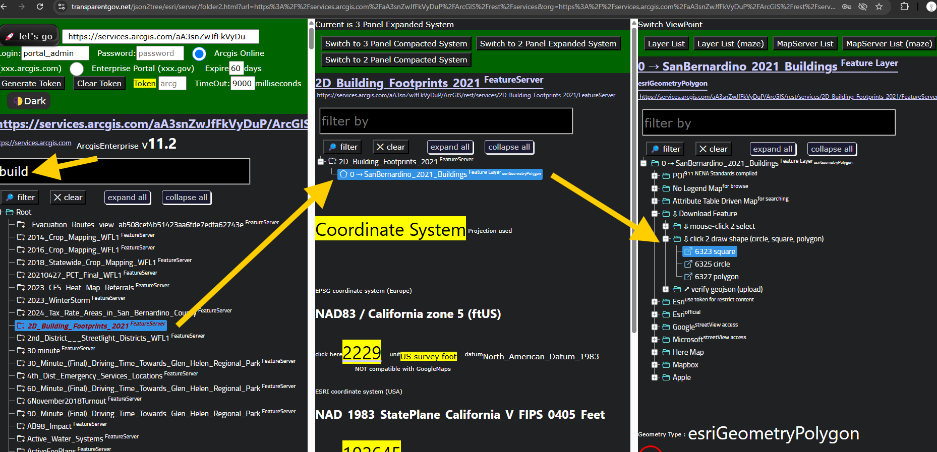
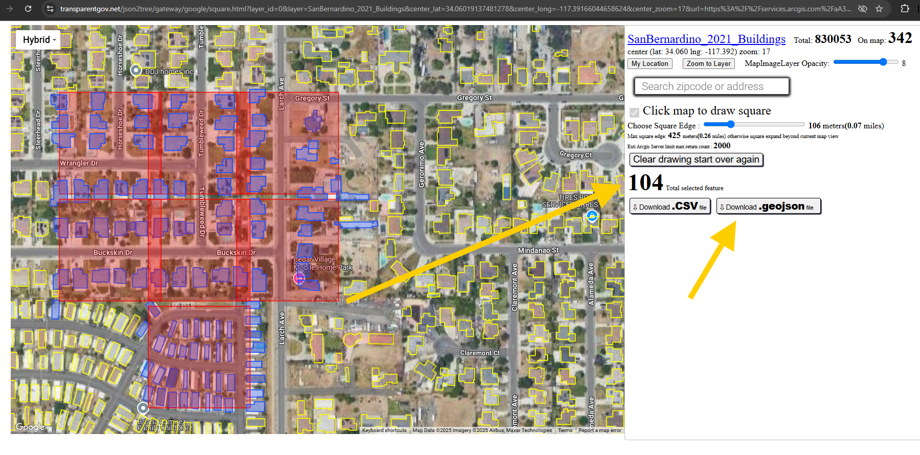
Step 7.
model 6323, click anywhere on map, draw square to select building,
blue color are selected building, click download geojson button
https://transparentgov.net/json2tree/gateway/google/square.html?layer_id=0&layer=SanBernardino_2021_Buildings¢er_lat=34.06019137481278¢er_long=-117.39166044658624¢er_zoom=17&url=https%3A%2F%2Fservices.arcgis.com%2FaA3snZwJfFkVyDuP%2FArcGIS%2Frest%2Fservices%2F2D_Building_Footprints_2021%2FFeatureServer&panto=0
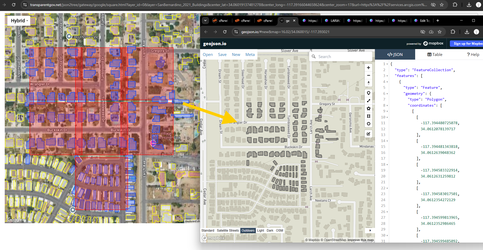
Step 8.
upload downloaded .geojson file to verify
the black bulding is exactly same as blue building which you downloaded.
https://geojson.io/#new&map=16.02/34.060015/-117.393021
Step 9.
You also can import .geojson into ArcPro or Qgis and convert it to shapefile or ESRI geodatabase. Now you can use the download building foot print with other ESRI layers together.