Step 1.
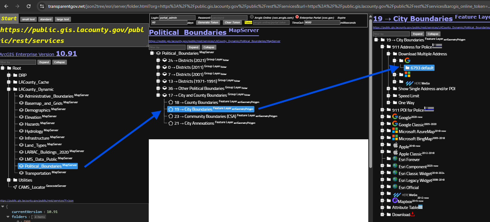
county address system is tax oriented, not accurate enough for 911 police use.
use google address collecting tool, 6793
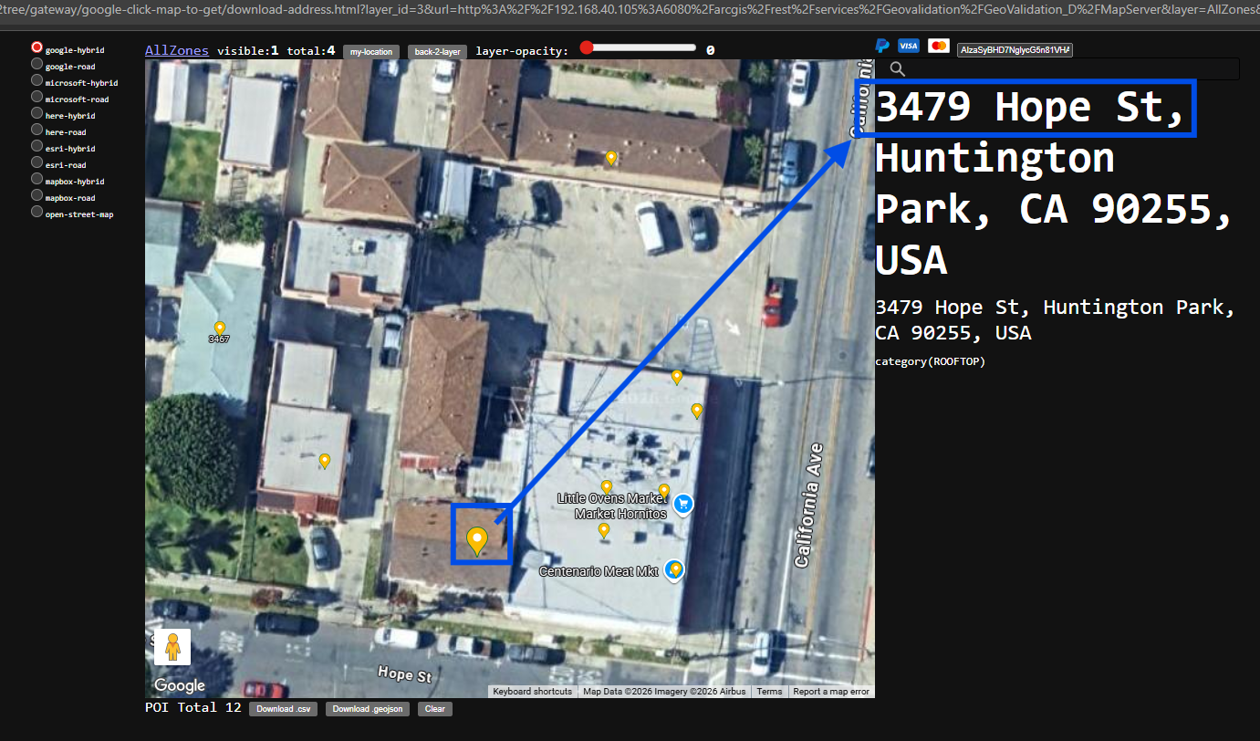
Step 2.
google address collecting tool, click any where on map, show nearby address point,
model 6793 is helping you to reveal all possible address from google address database.
3479 Hope St is a valid address in google database
https://transparentgov.net/json2tree/gateway/google-click-map-to-get/download-address.html?layer_id=19&url=https%3A%2F%2Fpublic.gis.lacounty.gov%2Fpublic%2Frest%2Fservices%2FLACounty_Dynamic%2FPolitical_Boundaries%2FMapServer&layer=City+Boundaries&panto=0¢er_lat=33.9681340167389¢er_long=-118.20430247874077¢er_zoom=20
Step 3.
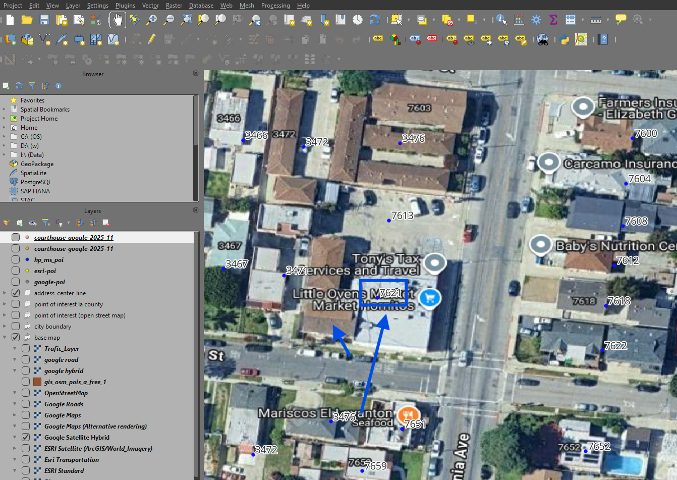
but county address system show only one address 7621 which is different from 3479
Step 4.
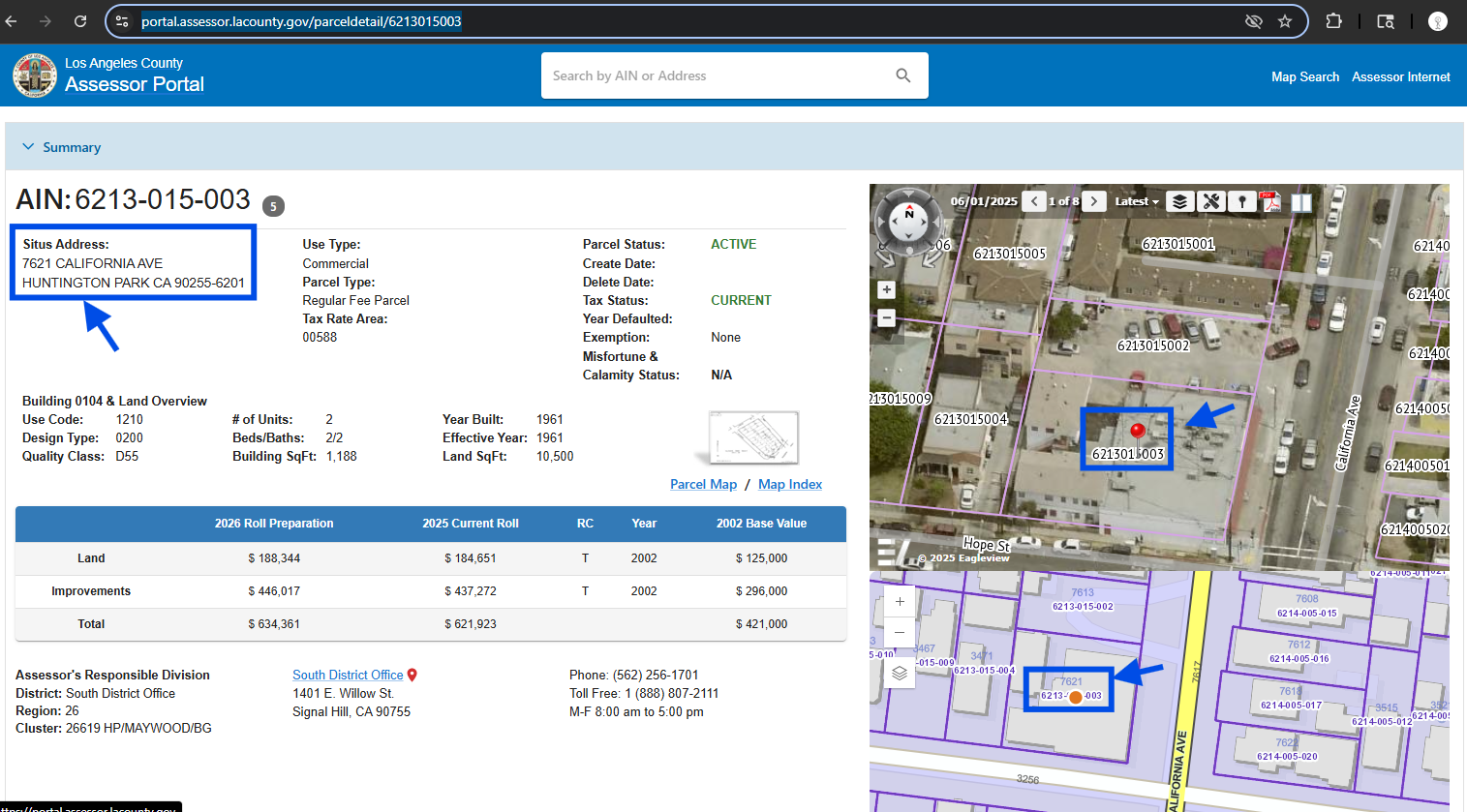
why is 7621 ? check county parcel tax map,
county tax parcel only record one address 7621 for this whole parcel,
you can see there are 3 building in this parcel, from google address tool, we know there are 6-7 address in this single parcel.
county address system is tax oriented, only record 7621, missing all the other 5 address
https://portal.assessor.lacounty.gov/parceldetail/6213015003
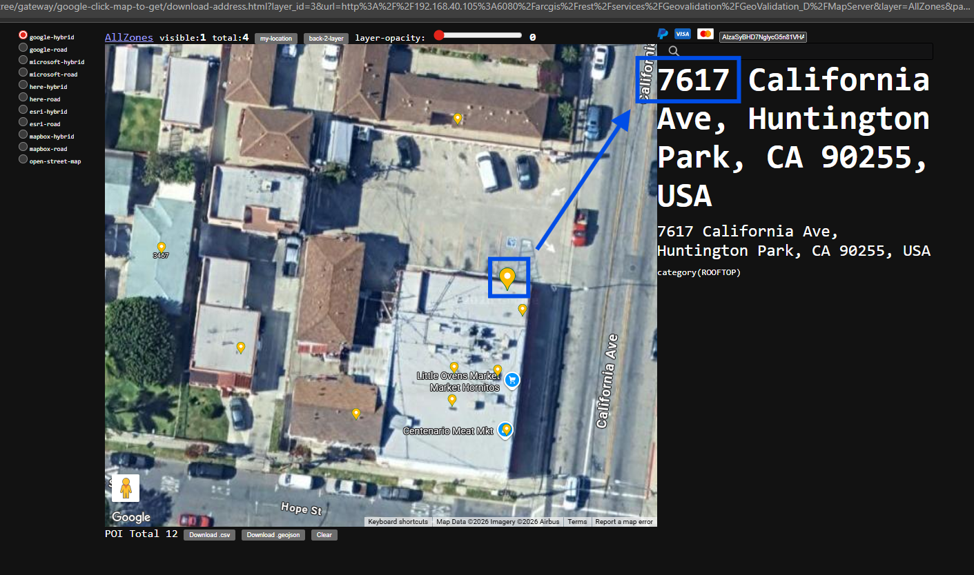
Step 5.
7617 is missing
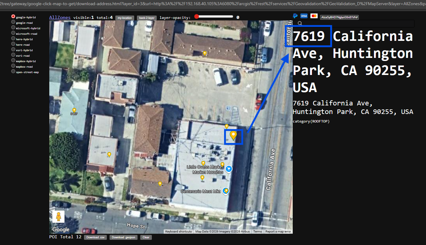
Step 6.
7619 is missing
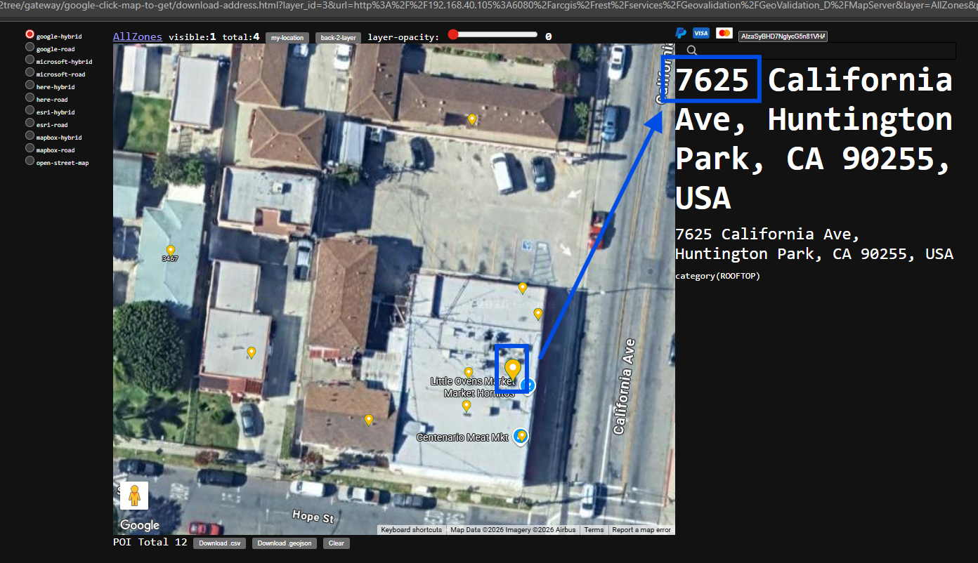
Step 7.
7625 missing
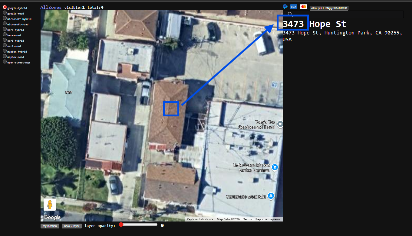
Step 8.
3473 is missing, this building seems like owner build extra structure in backyard for rent.
Step 9.
3479 is missing, this building seems like owner build extra structure in backyard for rent.

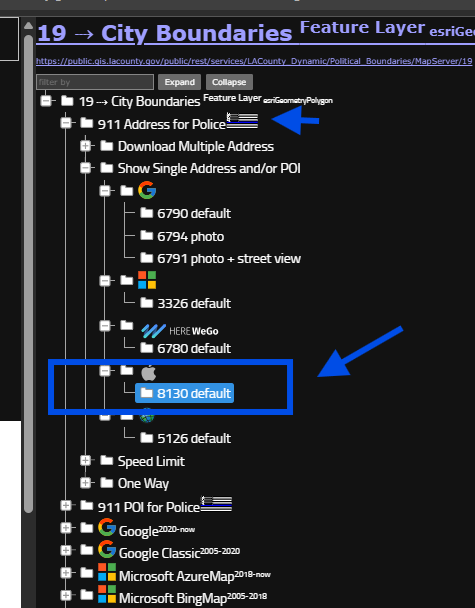
Step 10.
For 911 police use, 5 missing address actually are needed.
use model 8130 for apple
https://transparentgov.net/json2tree/esri/server/folder.html?org=https%3A%2F%2Fpublic.gis.lacounty.gov%2Fpublic%2Frest%2Fservices&url=https%3A%2F%2Fpublic.gis.lacounty.gov%2Fpublic%2Frest%2Fservices&arcgis_online_token=&timeout=9000&select_folder=17&select_layer=19&select_folder_text=Political_Boundaries+%3Csup%3EMapServer%3C%2Fsup%3E&select_layer_text=19+%26%23x21E2%3B+City+Boundaries+%3Csup%3EFeature+Layer%3Csub%3E+esriGeometryPolygon%3C%2Fsub%3E%3C%2Fsup%3E
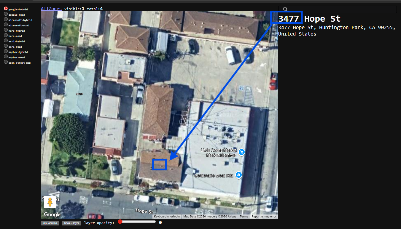
Step 11.
3477 revealed by apple address database, even Google failed to list 3477
https://transparentgov.net/json2tree/gateway/google-click-map-to-get/apple-show-address.html?layer_id=19&url=https%3A%2F%2Fpublic.gis.lacounty.gov%2Fpublic%2Frest%2Fservices%2FLACounty_Dynamic%2FPolitical_Boundaries%2FMapServer&layer=City+Boundaries&panto=0¢er_lat=33.96791196511472¢er_long=-118.20429053273948¢er_zoom=20
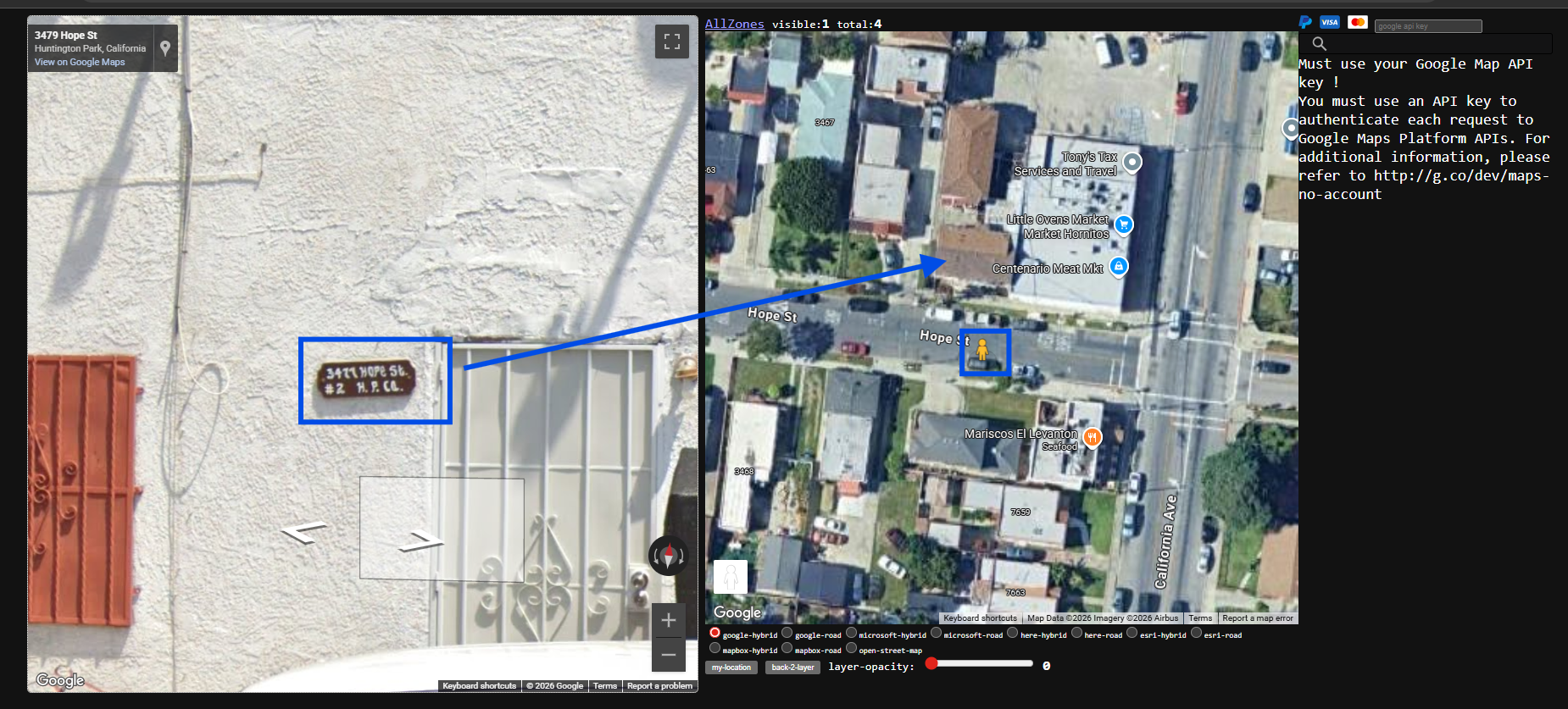
Step 12.
3477, can be confirmed by check google street view.
Owner print 3477 on wall
Step 13.
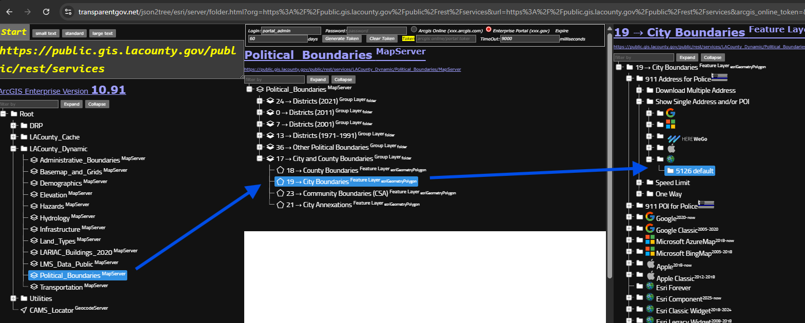
let's check out how ESRI's location platform runs.
use model 5126
https://transparentgov.net/json2tree/esri/server/folder.html?org=https%3A%2F%2Fpublic.gis.lacounty.gov%2Fpublic%2Frest%2Fservices&url=https%3A%2F%2Fpublic.gis.lacounty.gov%2Fpublic%2Frest%2Fservices&arcgis_online_token=&timeout=9000&select_folder=17&select_layer=19&select_folder_text=Political_Boundaries+%3Csup%3EMapServer%3C%2Fsup%3E&select_layer_text=19+%26%23x21E2%3B+City+Boundaries+%3Csup%3EFeature+Layer%3Csub%3E+esriGeometryPolygon%3C%2Fsub%3E%3C%2Fsup%3E
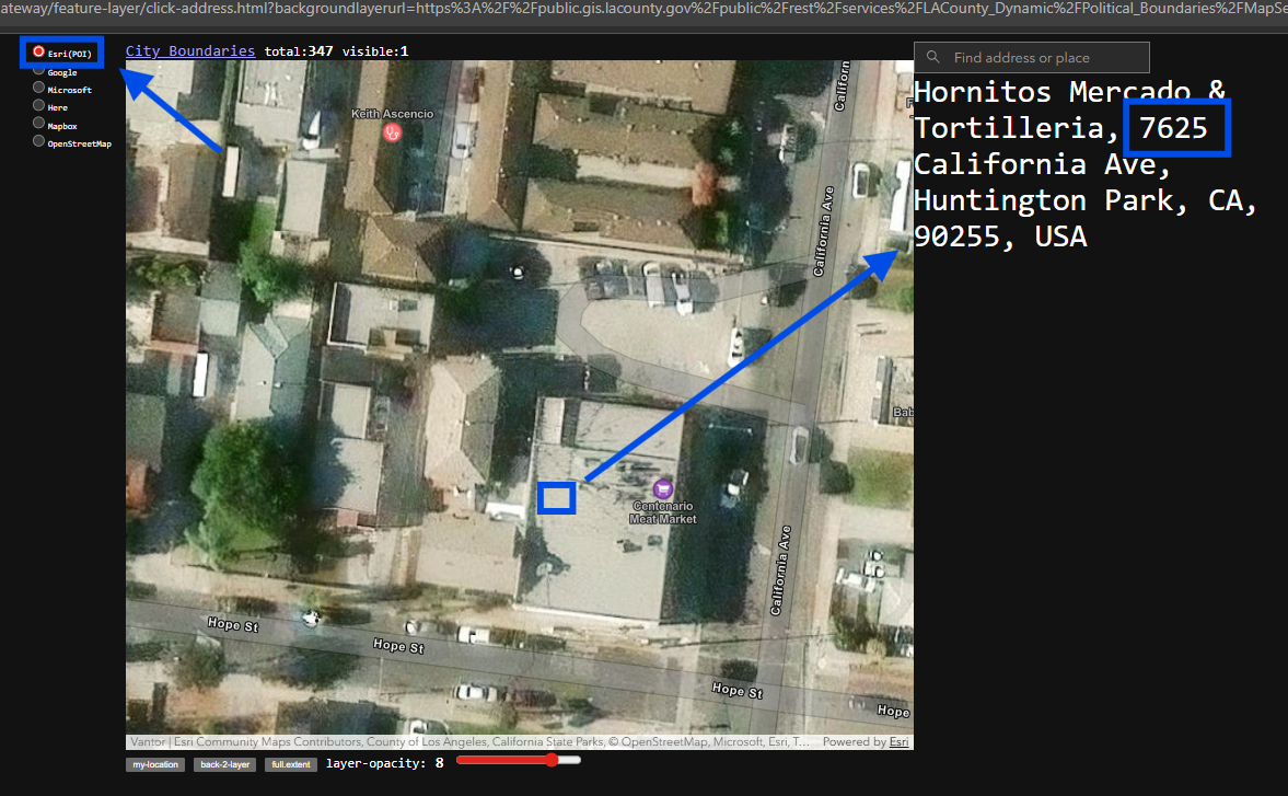
Step 14.
use model 5126, click the building roof,
esri only reveal single one address which is 7625
missing all 6 address previously revealed by google and apple,
https://transparentgov.net/json2tree/gateway/feature-layer/click-address.html?backgroundlayerurl=https%3A%2F%2Fpublic.gis.lacounty.gov%2Fpublic%2Frest%2Fservices%2FLACounty_Dynamic%2FPolitical_Boundaries%2FMapServer%2F19&layer=City+Boundaries&_center_lat=33.9681313524182&_center_long=-118.20437266064175&_center_zoom=20&panto=0&esriBaseMap=Esri%28POI%29
Step 15.
Step 16.
Step 17.
Step 18.
Step 19.
Step 20.