Step 1.
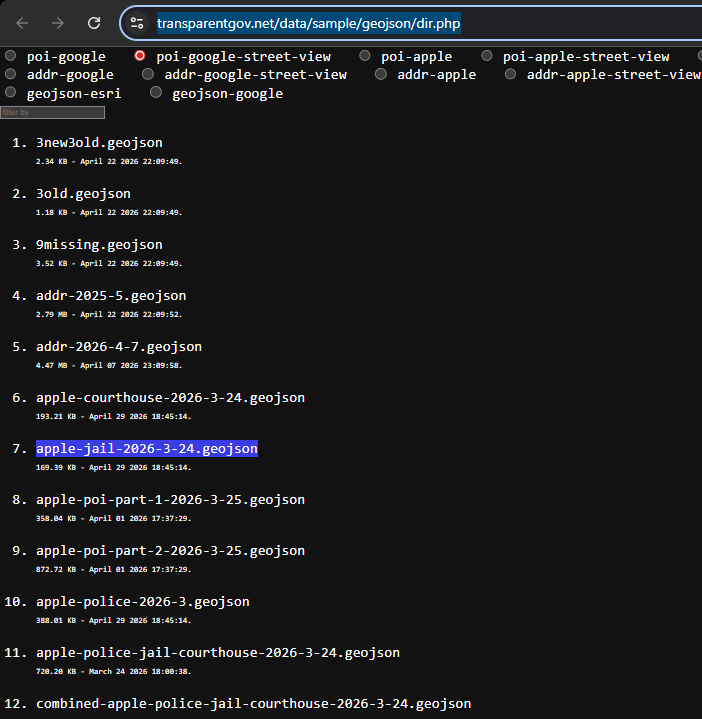
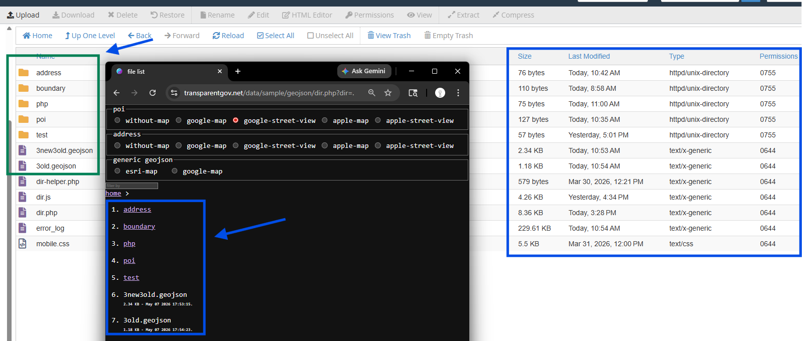
Here is all kinds of mix, address pieces, poi pieces from different time and source, police, hospital, mix
The problem is hard to find something, it is not organized by directory.
It is better to have address folder, where has all address,
poi folder where have all poi,
police folder where have all police, etc....
2025 folder where have all last year data,
2026 folder where have all this year data.
https://transparentgov.net/data/sample/geojson/dir.php
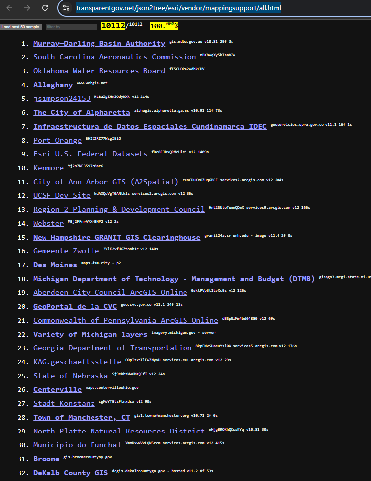
Step 2.
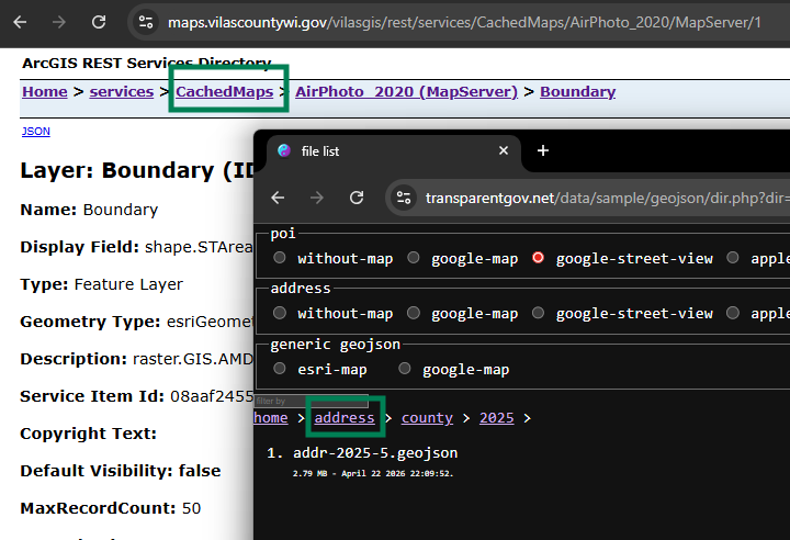
Here is sample of arcgis server, where all layer are organized by folder,
for example public work folder have zoning layer, general plan layer.
it is well organized structure.
Can geojson layer have something similar as arcgis server?
Being well organized structure to let user easy find something quickly?
https://transparentgov.net/json2tree/esri/vendor/mappingsupport/all.html
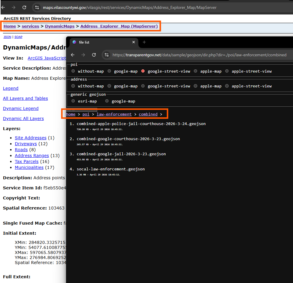
Step 3.
this is new geojson server (black)
https://transparentgov.net/data/sample/geojson/dir.php?dir=./poi/law-enforcement/combined
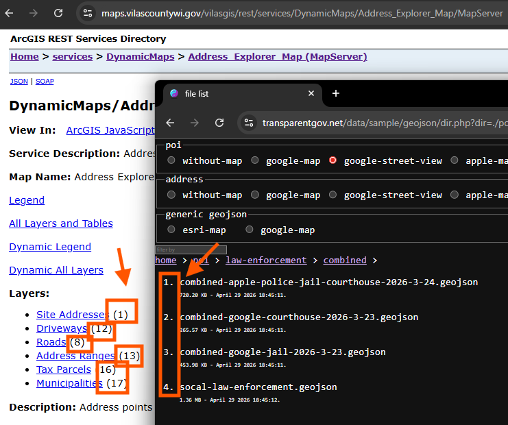
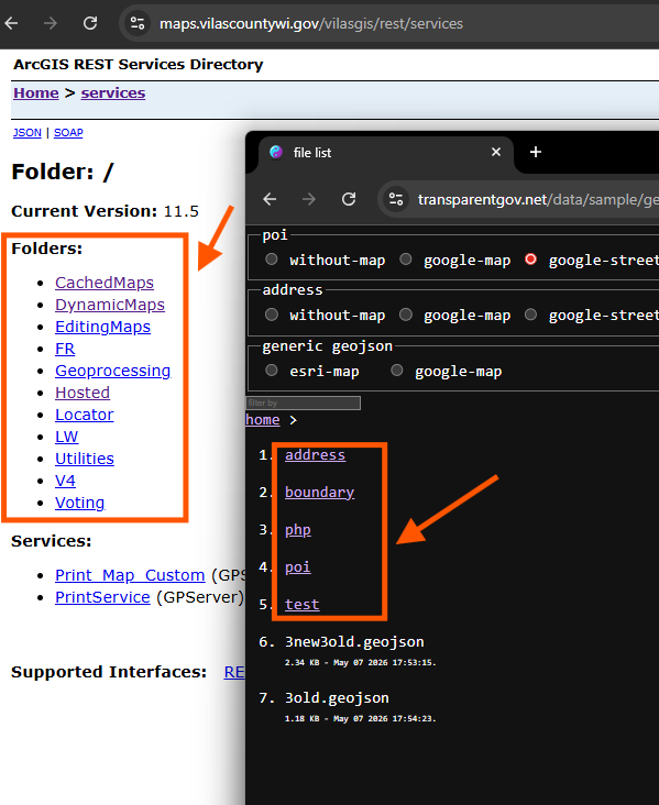
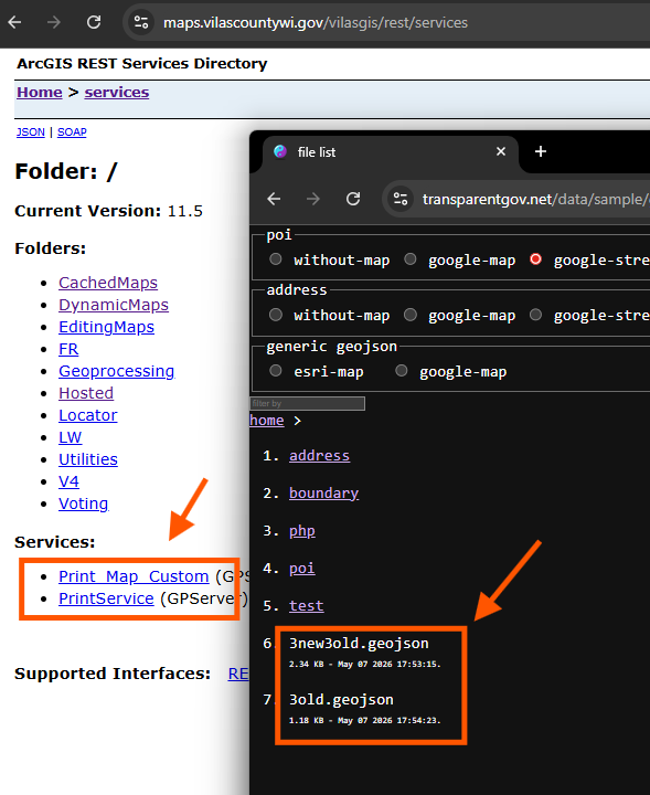
this is arcgis server, (white)
https://maps.vilascountywi.gov/vilasgis/rest/services/DynamicMaps/Address_Explorer_Map/MapServer
Step 4.
navigation bar
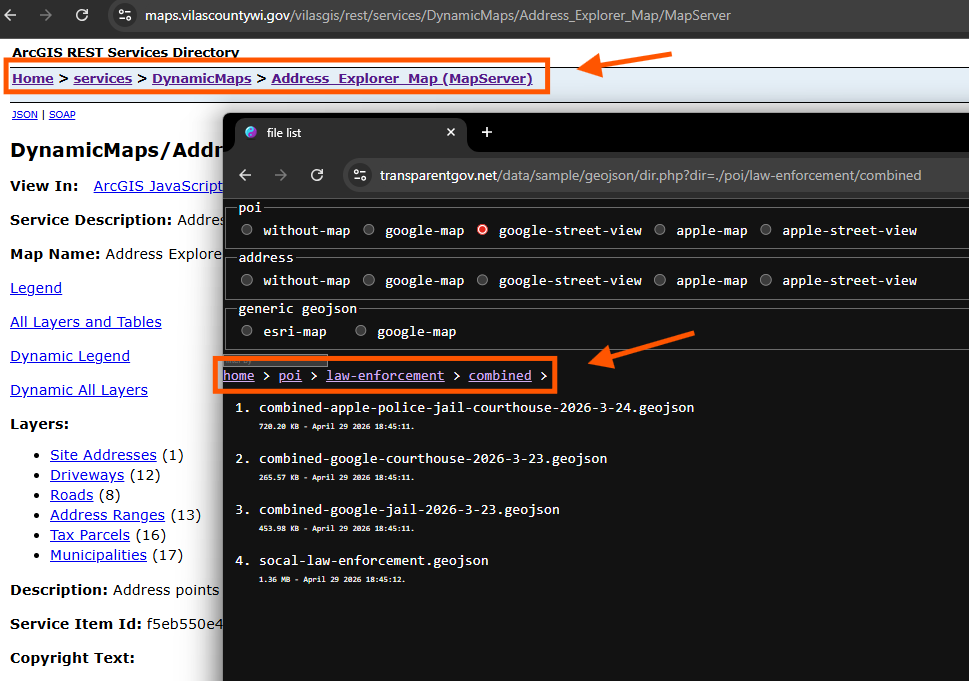
Step 5.
layer id
Step 6.
folder
Step 7.
layers
Step 8.
what is the difference then?
Arcgis server only allow you max have 1 level folder, plus MapServer is some kind of folder, that is it.
So for arcgis server, you max can have 2 level deep folder structure, top-level-folder and MapServer(sub-folder).
Step 9.
geojson server allow you to have folder structure as deep as you want. No limit.
black sample has 3 level deep folder, you can have 4, 5 level as you want, no limit.
Why is that. Because arcgis server folder structure is not build on physical hard drive, is not physical folder on operation system on hard drive.
Instead, arcgis use virtual folder to let it looks like a folder, but it isn't a real folder.
However, geojson server is build on real folder, on real hard drive,
this is folder structure on real hard drive, it is same as on web site.
Step 10.
Note:
arcgis server can not have more than 2 level deep folder structure since 20 years ago when they appear.
Possible due to it use virtual directory instead of physical directory in operating system.
Step 11.
Another difference is geojson server only deal with geojson format. Nothing else.
Arcgis server does not deal with geojson.
Arcgis server deal with ESRI's format only, shape file, feature dataset, etc....
Geojson server act as counterpart of arcgis server
Police poi and address is collected from google, apple, microsoft, mapbox, here,
Intuitively I need geojson server as counterpart of arcgis server to manage these POI, Address
Step 12.
Step 13.
Step 14.
Step 15.
Step 16.
Step 17.
Step 18.
Step 19.
Step 20.