Step 1.
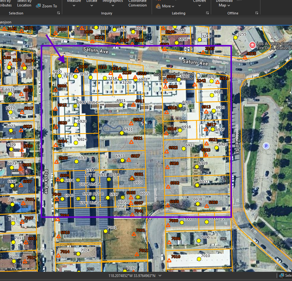
parcel line show these was seperated house, now convert to school.
red triangle ( historic address)
yellow circle with diamond ( historical address with unit )
Now school should only use one address.
Yellow circle is county address,
Red triangle is mico-station converted address,
Diamond means that address has unit number or base address (for unit apt etc...)
For police use, we should remove all yellow circle, red triangle, then just use single one address for school.
Step 2.
Should LA county merge all old parcel into a big new parcel for new school ?
Well, LA county assessor will match what has legally happened, in this case, they build a new school on old parcel does not regard as a legal event. Does not trigger assessor to make any change. Orange county do merge parcel in such case, but LA county would not. In their mind, cost of merge parcel does not justified. So they frequently just leave them as is. They keep those old address and code them as "historical", when some old police case link to those address, you that these historical address exist at one point.
Step 3.
For police use, ideally they need one single address for school, also they need floor plan show every room by room number, use arcgis-indoor product link to Motorola Flex. ( Flex does support arcgis-indoor product ). So police will know which room number on what floor is impacted when things happen.
Step 4.
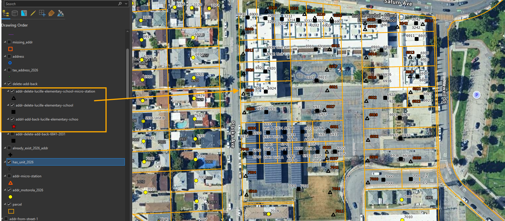
To avoid manually delete, add ( manual operation is not repeatable, not automatic )
To automate the address change, need create these 3 layers, so the tool can automatically do the address updating process.
The whole address change is repeatable, is automated,
Step 5.
Step 6.
Step 7.
Step 8.
Step 9.
Step 10.
Step 11.
Step 12.
Step 13.
Step 14.
Step 15.
Step 16.
Step 17.
Step 18.
Step 19.
Step 20.
Step 21.
Step 22.
Step 23.
Step 24.
Step 25.
Step 26.
Step 27.
Step 28.
Step 29.