1). Who create this concept?
Esri.
2). Why they create 2 things instead of One thing? to confuse you?
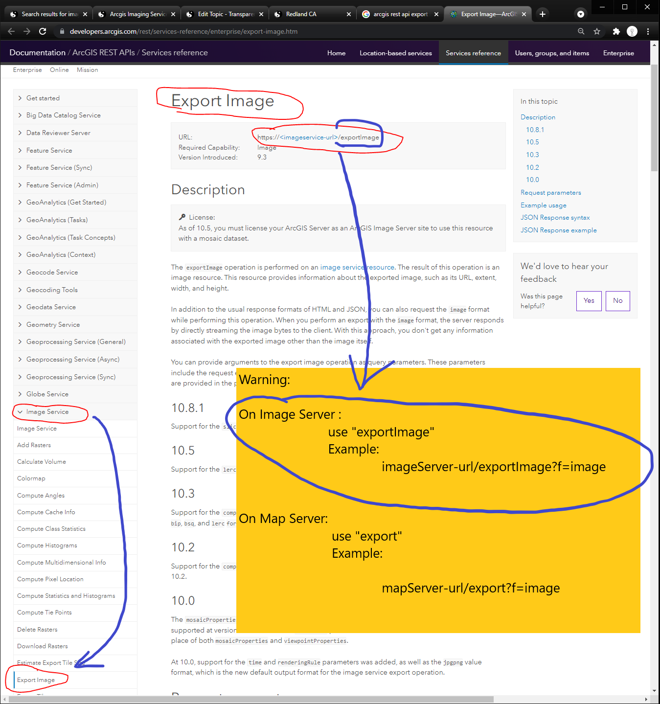
3). What is difference?
ImageServer - exportImage?f=image
MapServer - export?f=image
https://developers.arcgis.com/rest/services-reference/enterprise/export-image.htm
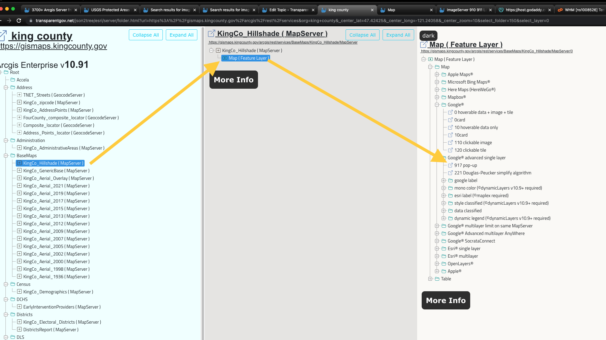
4). MapServer ImageService
Is same as MapServer, but output a real jpeg, png image.
ESRI arcgis js api, have a special class named "mapimagelayer" allow you display exported real image.
https://transparentgov.net:3200/googlemaps917/default?layer_id=0&layer=Map¢er_lat=47.433745493330825¢er_long=-121.80399320349125¢er_zoom=9&url=https%3A%2F%2Fgismaps.kingcounty.gov%2Farcgis%2Frest%2Fservices%2FBaseMaps%2FKingCo_Hillshade%2FMapServer&overlayType=overlayType_image&panto=0

https://transparentgov.net:3200/googlemaps917/default?layer_id=0&layer=Map¢er_lat=47.46656785991071¢er_long=-121.94544217810062¢er_zoom=11&url=https%3A%2F%2Fgismaps.kingcounty.gov%2Farcgis%2Frest%2Fservices%2FBaseMaps%2FKingCo_Aerial_2019%2FMapServer&overlayType=overlayType_image&panto=0

King County
https://transparentgov.net/json2tree/esri/server/folder.html?url=https%3A%2F%2Fgismaps.kingcounty.gov%2Farcgis%2Frest%2Fservices&org=king+county&_center_lat=47.42425&_center_long=-121.24058&_center_zoom=10&select_folder=145&select_layer=0
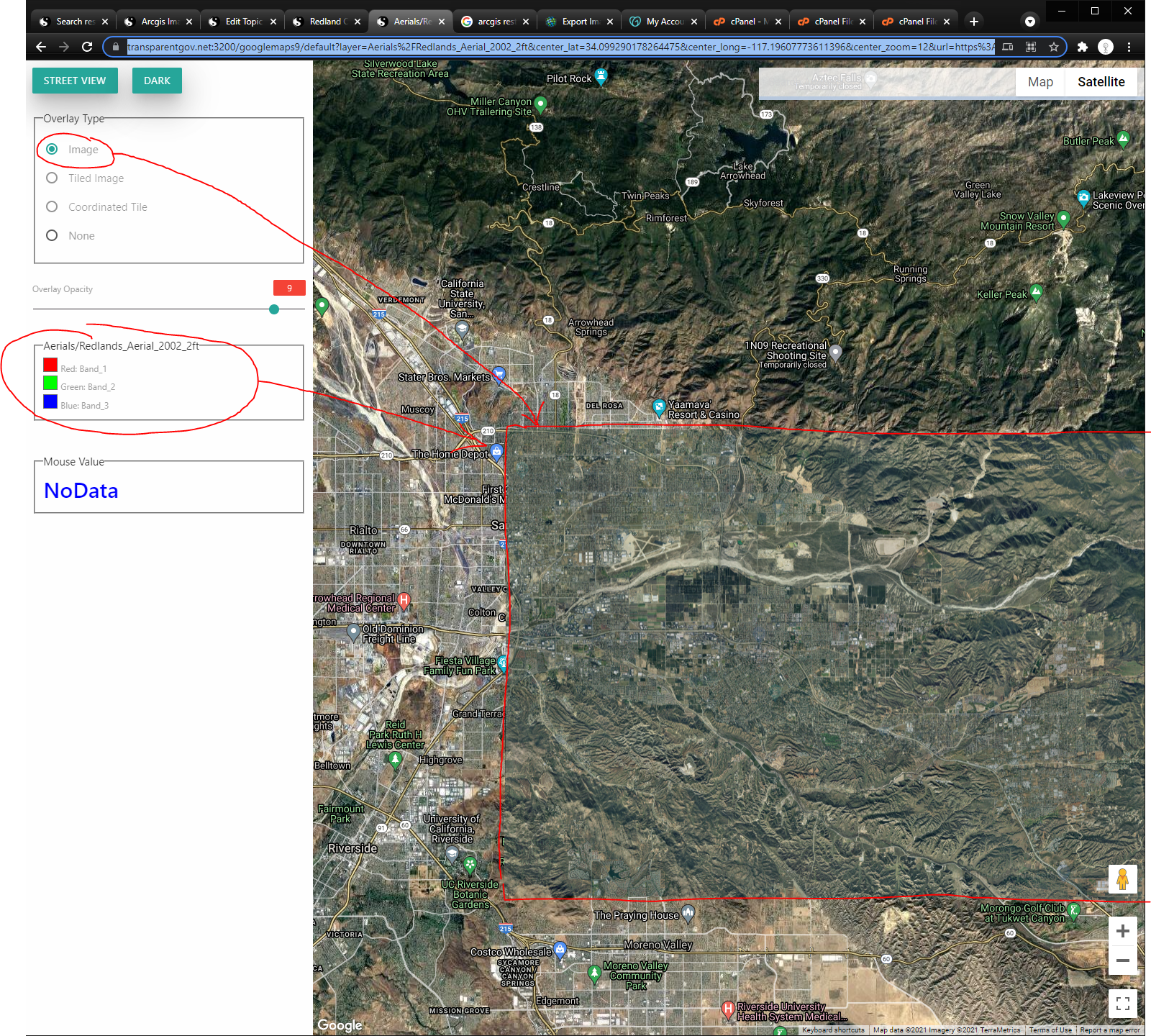
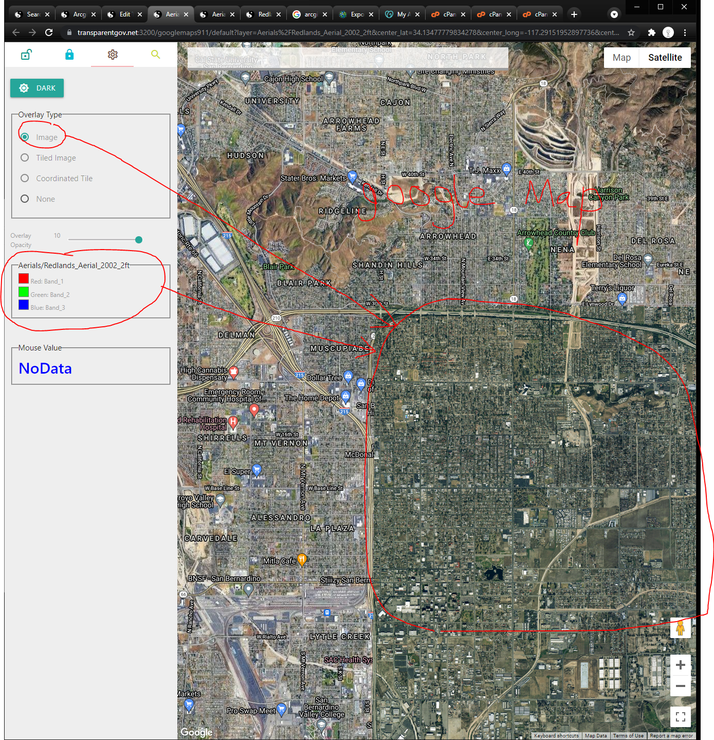
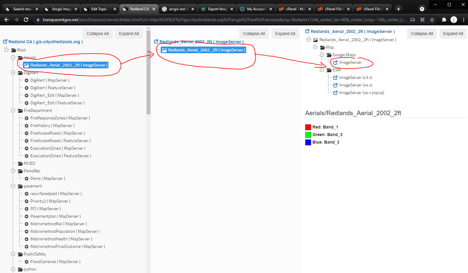
5). ImageServer
Never output feature, only output real jpeg, png image.
ESRI arcgis js api, have a special class named "imageryLayer" allow you display exported real image.
https://transparentgov.net:3200/googlemaps9/default?layer=Aerials%2FRedlands_Aerial_2002_2ft¢er_lat=34.099290178264475¢er_long=-117.19607773611396¢er_zoom=12&url=https%3A%2F%2Fgis.cityofredlands.org%2Farcgis%2Frest%2Fservices%2FAerials%2FRedlands_Aerial_2002_2ft%2FImageServer&panto=0
Tabs version https://transparentgov.net:3200/googlemaps911/default?layer=Aerials%2FRedlands_Aerial_2002_2ft¢er_lat=34.099290178264475¢er_long=-117.19607773611396¢er_zoom=12&url=https%3A%2F%2Fgis.cityofredlands.org%2Farcgis%2Frest%2Fservices%2FAerials%2FRedlands_Aerial_2002_2ft%2FImageServer&panto=0
https://transparentgov.net/json2tree/esri/server/folder.html?url=https%3A%2F%2Fgis.cityofredlands.org%2Farcgis%2Frest%2Fservices&org=Redland+CA&_center_lat=40&_center_long=-74&_center_zoom=17&select_folder=248&select_layer=-1
6). real difference is just the way how you use it. Since esri create these 2 things, gives you two different way to use them, you will have to follow this rules.
It is like coca cola can vs rocket compression tank, both of them are compression container, but the way to use is differently.
Same idea, both of image server and image service are output jpeg.png real image. but the way how you create them are different.
7). Confusing? Yes. How about combine both things into one?
Of course, in some condition, when you create apps, you can combine them into same way.