For how to inject four model into the single zoning shape file, please click here
https://transparentgov.net/cleargov1/860/how-to-inject-model-into-feature-layer
https://transparentgov.net/cleargov1/858/how-to-compress-multiple-layers-into-one
Model 4
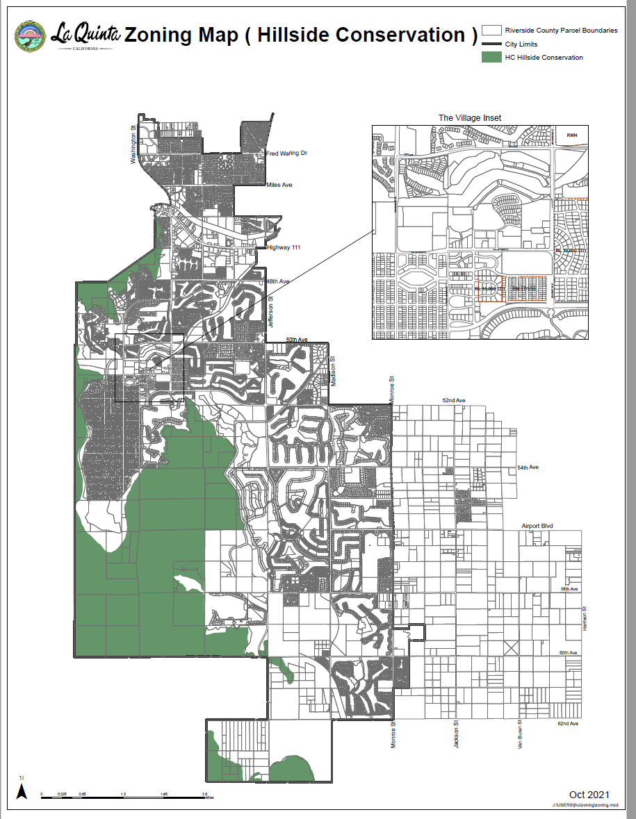
Hillside Conservation Overlay District PDF is here ( use ZoneCode4, ZoneName4 )
municiple code is here https://library.municode.com/ca/la_quinta/codes/municipal_code?nodeId=TIT9ZO_CH9.110SPPUOVDI_9.110.070HCHICOOVDI
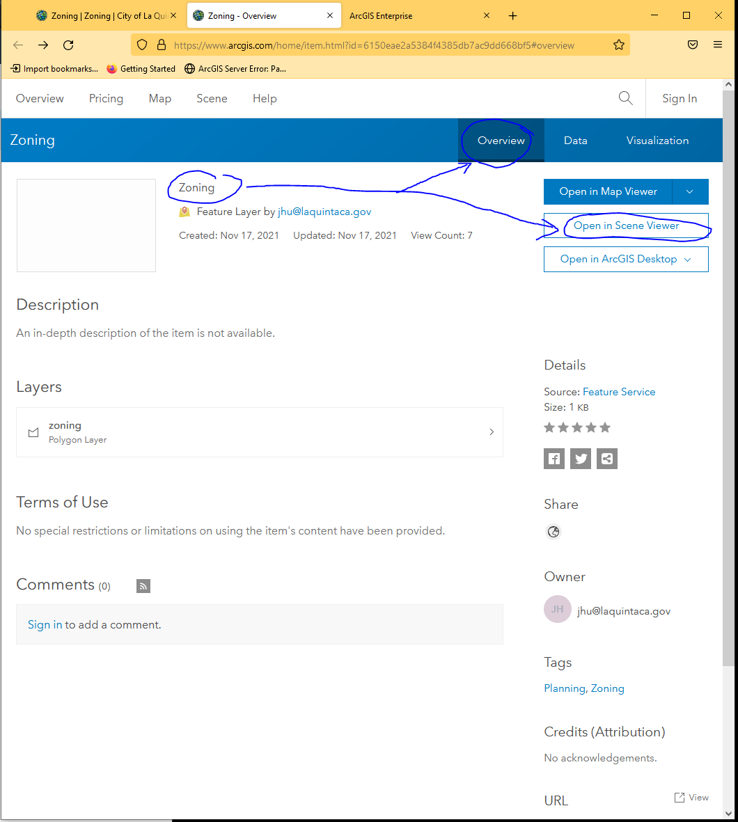
 Open Zoning Map at Arcgis online
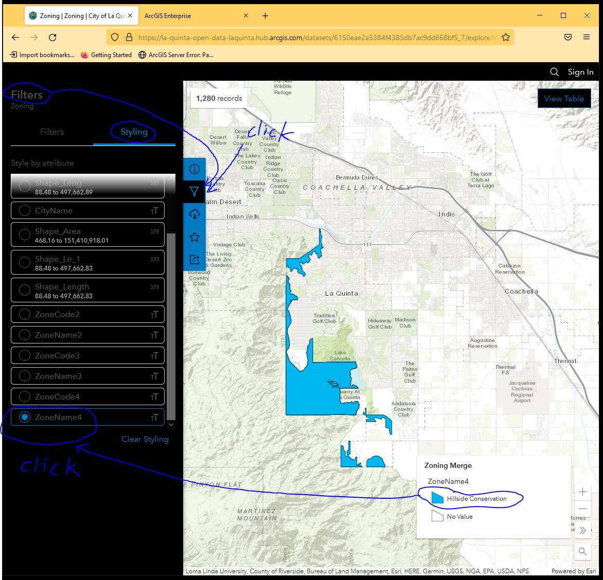
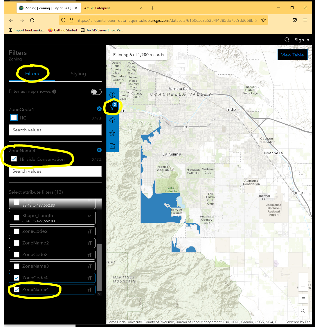
Click filter icon --> click styling tab --> choose ZoneName4
https://la-quinta-open-data-laquinta.hub.arcgis.com/datasets/6150eae2a5384f4385db7ac9dd668bf5_7/explore?location=33.660790%2C-116.251350%2C12.00&style=ZoneName4
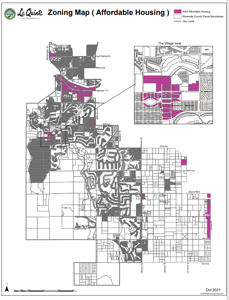
Model 3
AHO Affordable Housing Overlay District PDF (use ZoneCode3, ZoneName3 )
Municipal Code is here: 9.110.100 - AHO Affordable Housing Overlay District. | Municipal Code | La Quinta, CA | Municode Library
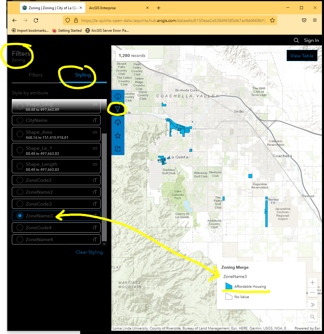
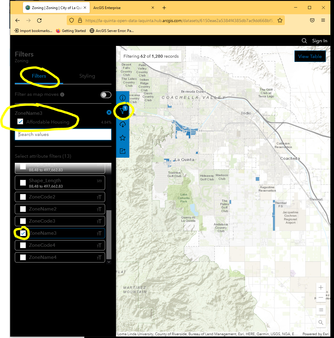
Open Zoning Map at Arcgis online
Click filter icon --> click styling tab --> choose ZoneName3
https://la-quinta-open-data-laquinta.hub.arcgis.com/datasets/6150eae2a5384f4385db7ac9dd668bf5_7/explore?location=33.650217%2C-116.240364%2C12.00&style=ZoneName3
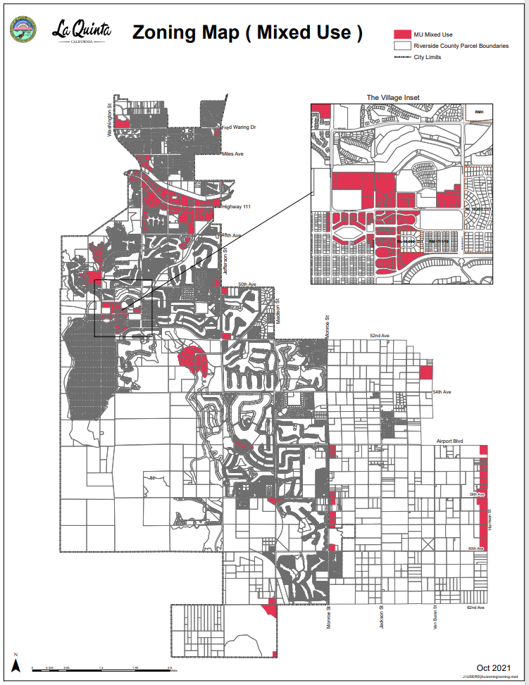
Model 2
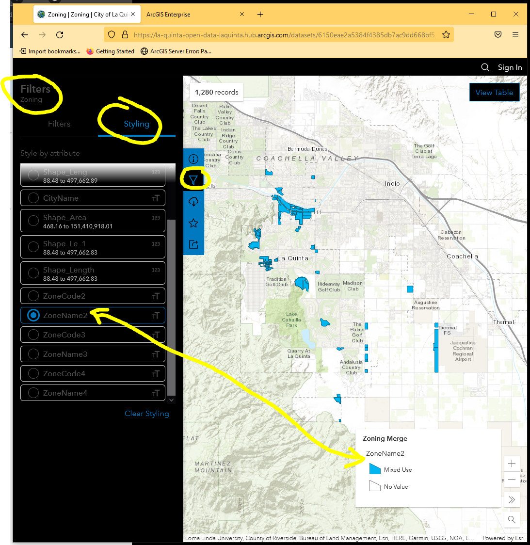
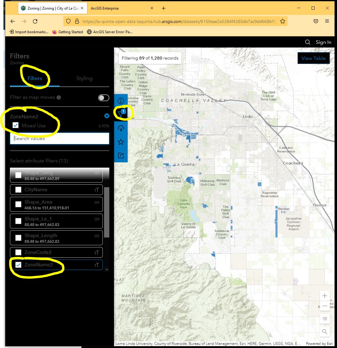
MU Mixed Use Overlay District PDF ( use ZoneCode2, ZoneName2 )
Municipal Code is here: 9.110.120 - Mixed Use Overlay District. | Municipal Code | La Quinta, CA | Municode Library
Open Zoning Map at Arcgis online
Click filter icon --> click styling tab --> choose ZoneName2
https://la-quinta-open-data-laquinta.hub.arcgis.com/datasets/6150eae2a5384f4385db7ac9dd668bf5_7/explore?location=33.650217%2C-116.240364%2C12.00&style=ZoneName2
Model 1
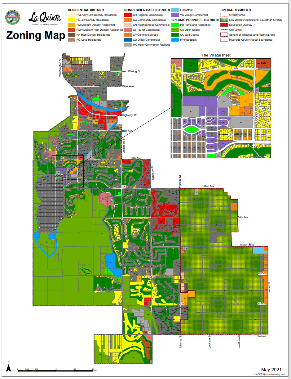
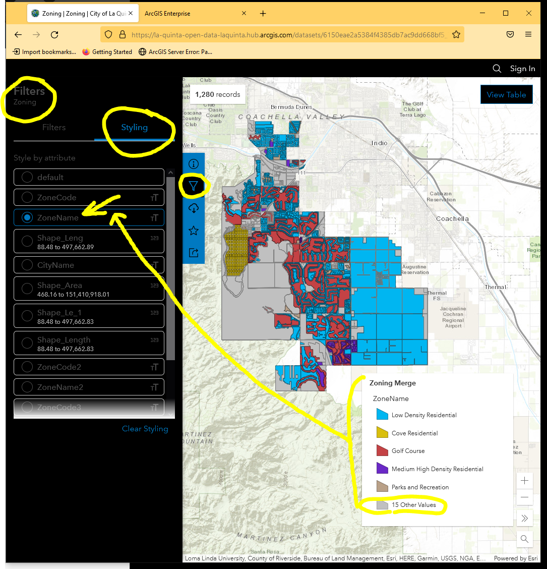
Basic Zoning District PDF is here zoning district, ( use ZoneCode, ZoneName )
Open Zoning Map at Arcgis online
Click filter icon --> click styling tab --> choose ZoneName
https://la-quinta-open-data-laquinta.hub.arcgis.com/datasets/6150eae2a5384f4385db7ac9dd668bf5_7/explore?location=33.623919%2C-116.226287%2C12.00&style=ZoneName
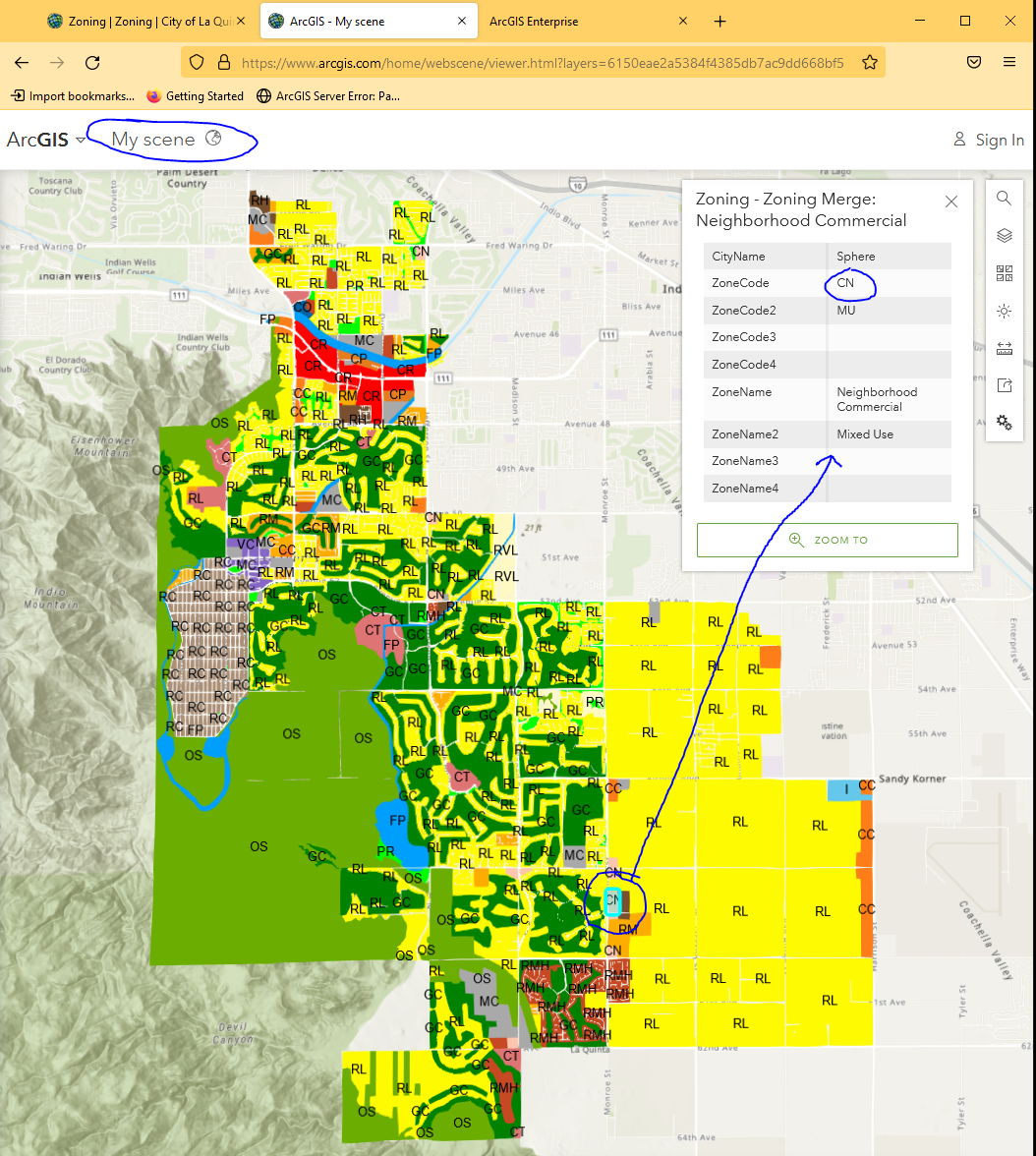
view in Scene Viewer
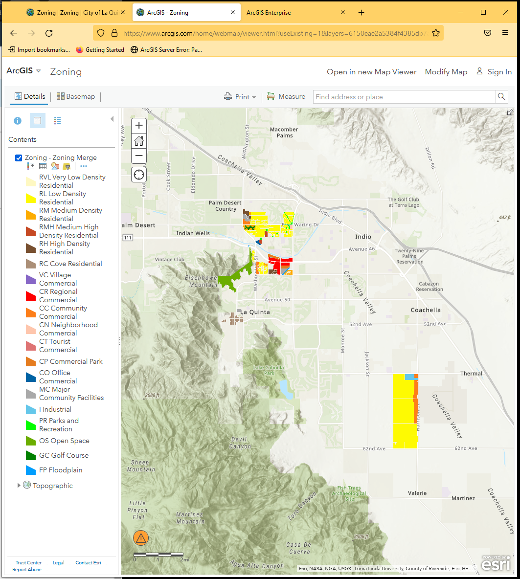
view in Classic Map Viewer
view in Visulization
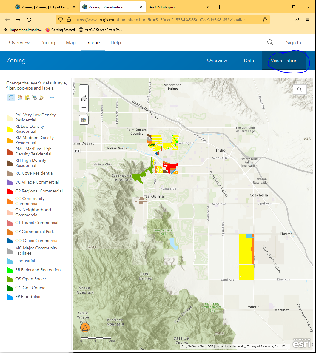
There are multiple way to look at basic zoning model, classic map viewer, scene viewer, visulization tool